
Eagle Rock via the Pacific Crest Trail Hike
Saturday, April 17, 2021
 EAgle Rock via the Pacific Crest Trail
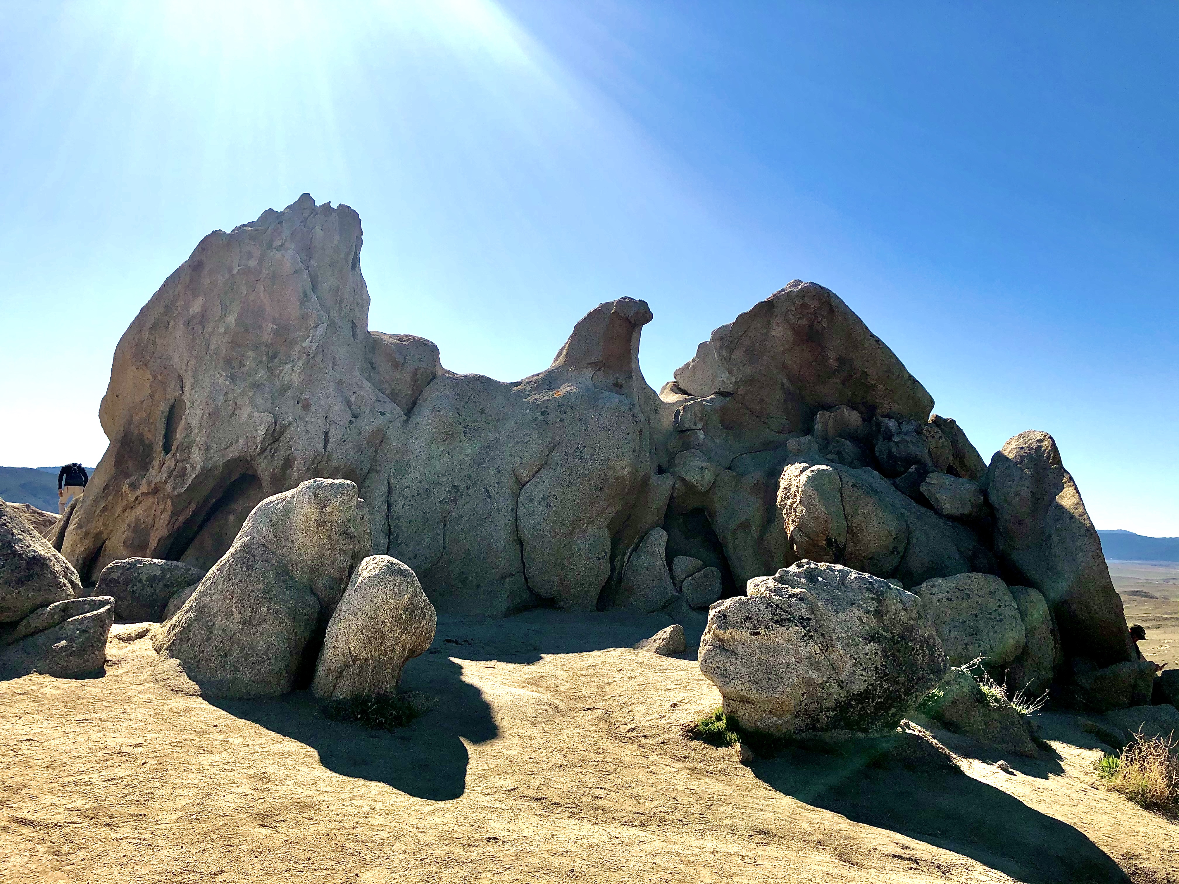
Join the Hiking Ministry family from the Rock Church for our first destination hike of 2021. Our adventure will take us to Warner Springs as we hike on the Pacific Crest Trail (PCT) to the amazing Eagle Rock formation. It's always a fun time of hiking, fellowship and worship as we enjoy the beauty of God's creation!
To reach our destination, we will be driving 1.25 hours to Warner Springs to reach the junction of the Pacific Crest Trail and SR-79. We will travel south on the PCT until we reach our destination at Eagle Rock. The 6.5-mile round-trip hike is moderate, starting with a shady trail with a creek view, eventually opening up to an open field with no shade. The rock formation is truly incredible!
More info on the hike can be found here.
Note: This is a moderate-level hike, but please be honest and self-evaluate your physical ability before attempting this hike. It could be challenging for those who are heat-sensitive. We may also encounter equestrians and cattle. There are no facilities at the trailhead or on the trail.
We can stop for lunch and pie in Santa Ysabel on our way back.
Meet at the trailhead at 8:45 a.m. No carpool will be available, due to COVID-19, but we can caravan to Warner Springs from the Rock Church East County campus, 808 Jackman St., El Cajon 92020. Meet at 7:15 a.m. for a 7:30 a.m. departure. Contact Vinnie at hike@sdrock.com if you are interested in this option.
Hope to see you all there!
"Let love be without hypocrisy. Abhor what is evil. Cling to what is good." - Romans 12:9 NKJV
Difficulty: Moderate, shady start with no shade on the the last mile+ to Eagle Rock
Highlight: An amazing rock formation that looks like an eagle
Distance: 6.5 miles (round trip)
Elevation Gain: 988'
Hiking Time: approximately 3 hours
Travel Time: 1 hour 20 minutes each way
Dogs on leash are permitted, but not recommended. (There will be horses and cattle)
The long drive and hike may be difficult for young children's attention spans
Hike will be canceled if it rains.
Pacific Crest Trail and SR-79
31049 CA-79, Warner Springs, CA 92086
Next to CALFIRE Station. There is street parking and a small dirt parking lot.
I-8 to SR-67 to Ramona where it becomes SR-78. Continue on SR-78 to Santa Ysabel. Turn left at SR-79 (by Dudley's Bakery). Continue on SR-79 for 13.8 miles to the trailhead. The trailhead is on the South side of SR-79.
No carpool will be available due to COVID-19.
For more info, please contact Vinnie Freeman at hike@sdrock.com